Bikepacking the Sierra Morena
Cycling Andalucia differently: off-road trails linking ancient hill towns and villages in the heart of Spain’s ham country. Roughly following the Transandalus and GR48 for 230km of gravel, mountain bike routes and quiet roads between Aroche and Hornachuelos.
Part 3 of my version of the European Divide Trail
The experience
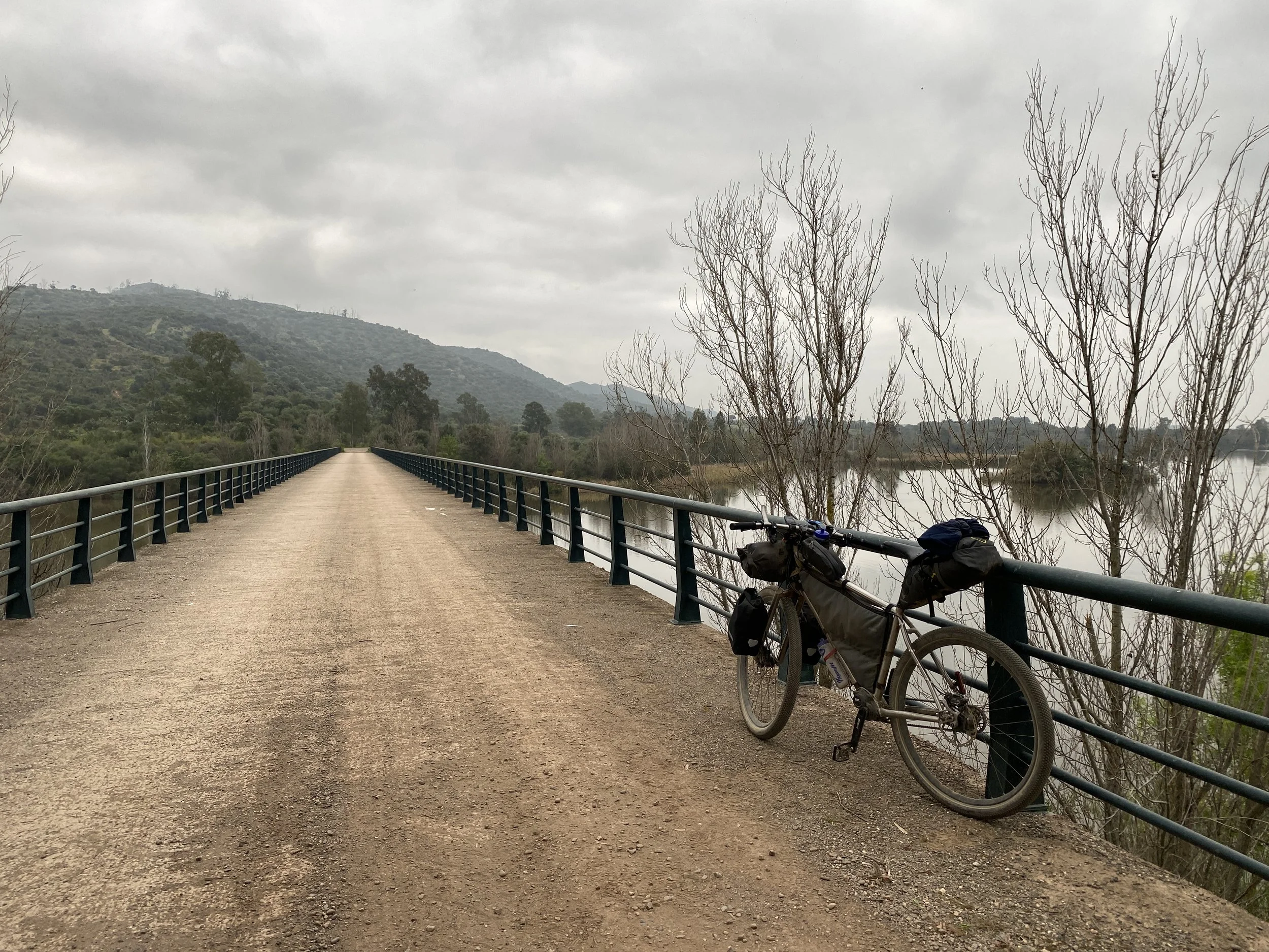
It’s early morning, there’s a chill in the air and there’s no wind. Deep breaths bring just a little cloud of vapour, swirling into the cold air. The crunch of gravel beneath the bike is as constant as the noise from wind moving past my ears as I cycle downhill. I could go much faster but that would change the setting: this is a peaceful pace; the only sounds not coming from my presence are the birds talking and singing to each other.
Along the sides of the track are wildflowers and lush green grass. Green is everywhere. The light is flat but bright, the low clouds just beginning to show glimpses of sun. The views stretch for miles across a vast undulating green vista, partially obscured by low thin clouds. In the distance is a large lake. This feels like a lost world; I anticipate meeting a great ancient beast stalking the landscape. This isn’t, perhaps, what you’d expect cycling in Andalucia.
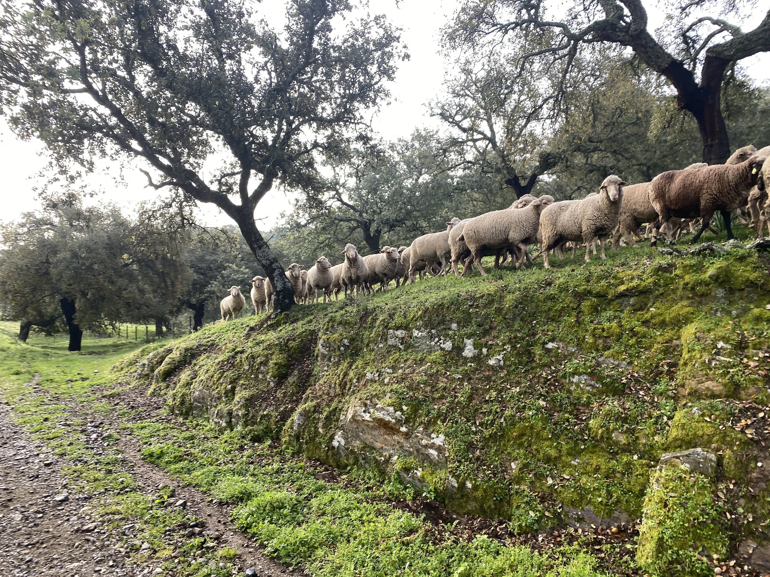
At times the broad vista disappears and I’m cycling up steep hills on ancient sunken tracks, the sides covered in moss and ferns. The tracks link and provide access to large open groves of oak trees and grass. This isn’t a forest, but neither is the space open; it has a unique feel, somewhat like parkland but the grass is overgrown and unkempt. Occasionally I spot small black pigs in the grass just standing there like black rocks on sticks.
Then a transition begins. The silence makes way for the bark of dogs and I begin to make out the angles of an ancient brown castle sitting on top of a white village. I’m entering town via unruly tracks so the outskirts I pass are small messy enclosures with fenced in chickens and tidy vegetable patches.
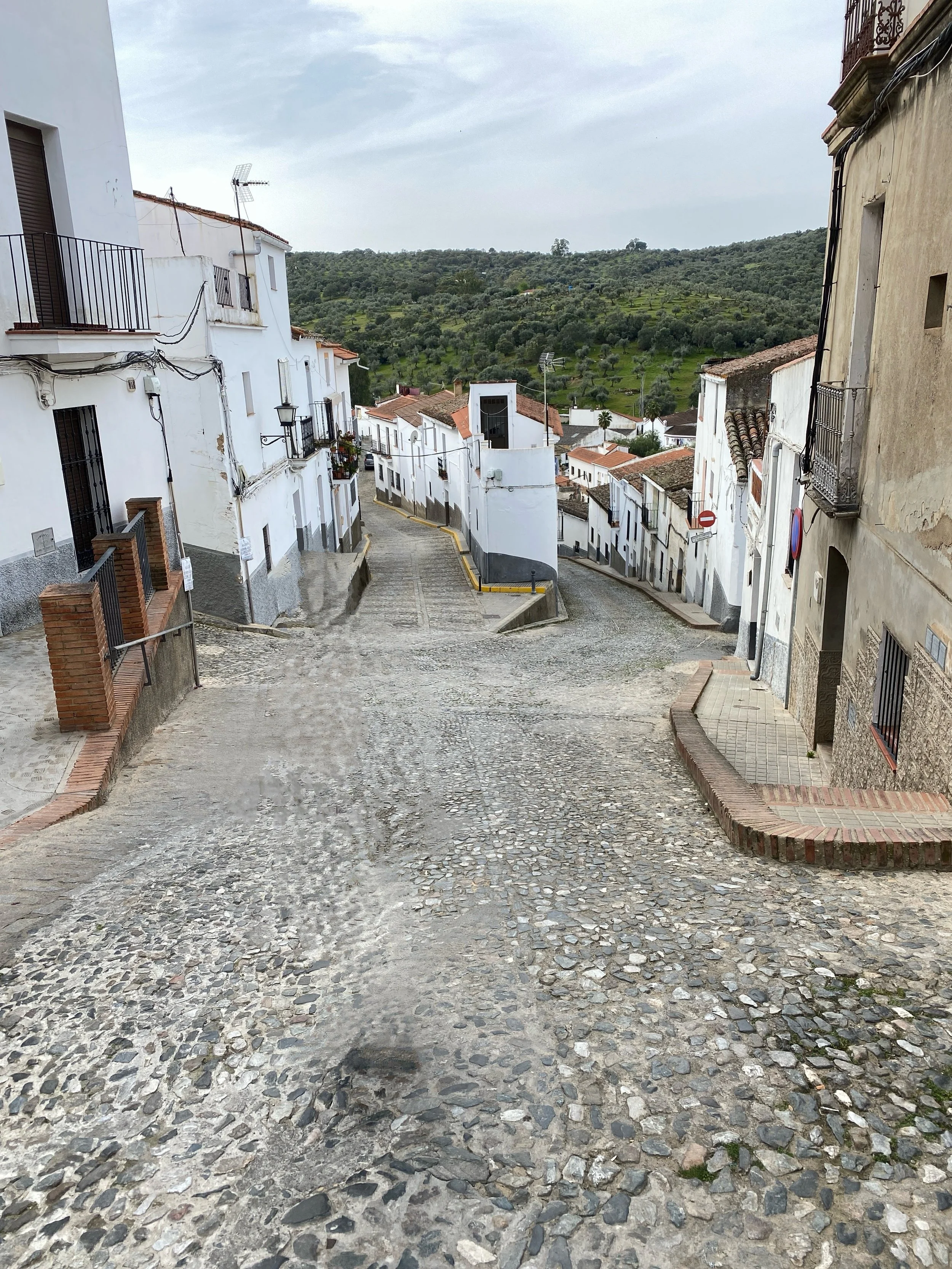
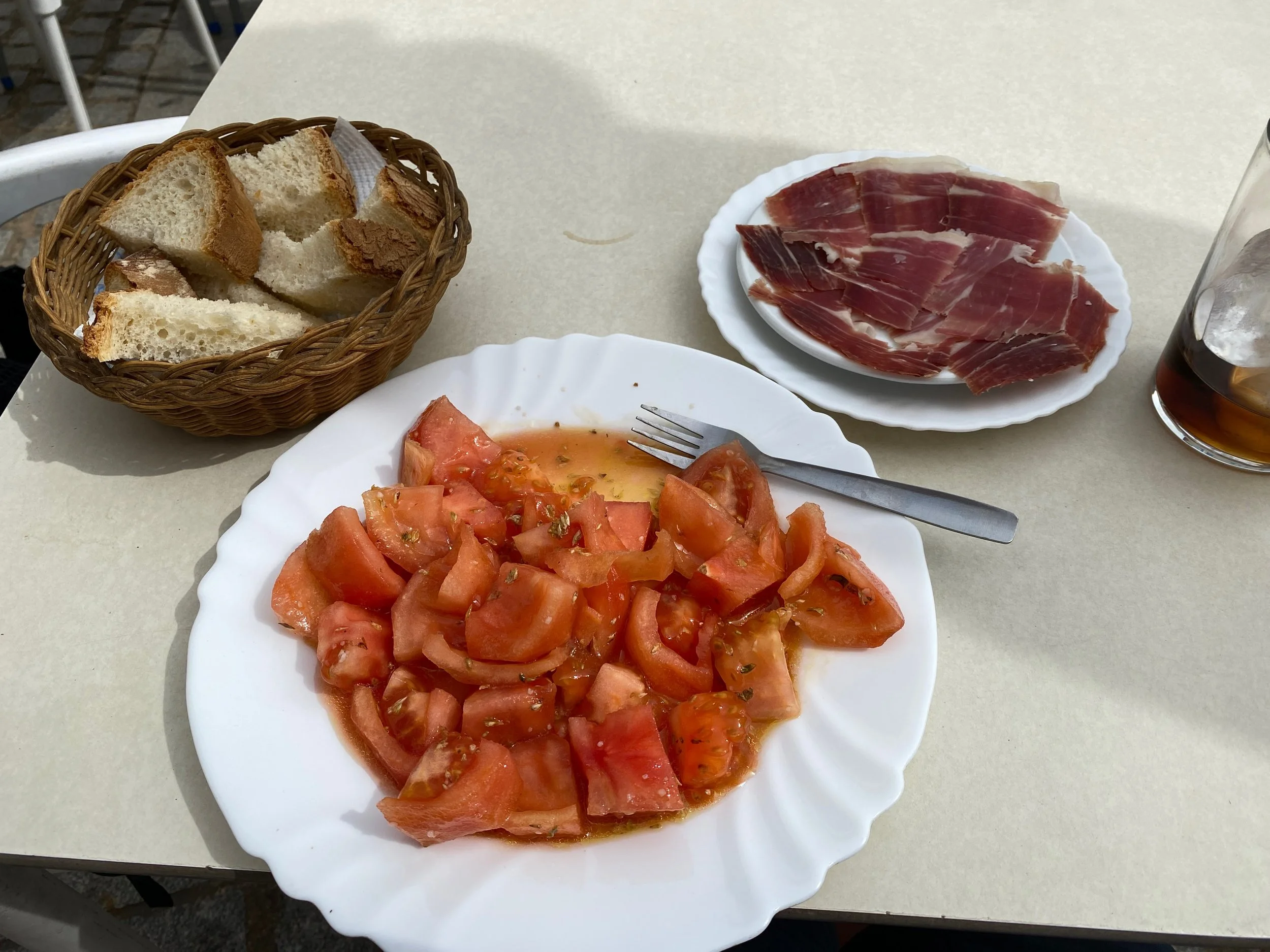
Then the streets start; cobbled and steep. I loop around until I come across a square in the middle of town. People are out, smartly dressed in jumpers, quilted jackets and dark sunglasses. Some are talking to each other, occasionally shouting, others sitting quietly at bars and cafes enjoying the spring sunshine. Occasionally I sit down too, enjoying everything from a quick espresso to a full meal. The food is simple but exquisite, a plate of fresh tasty tomatoes, a plate of ham direct from the drying halls.
Then, as quickly as I arrived, I’m out of town again, sometimes into the next wilderness, at other times into the maze of zigzagging trails between the ancient oak groves.
This pattern of contrast between the green isolated rural quiet and the smart lively people in the white towns with their brown castles and cafes repeats a few times a day over the next few days until the final descent out of the mountains into the valley of the Guadalquivir and the town of Hornachuelos.
Statistics
Distance: 227km, 3 days
Climb: 3694m, moderate.
Difficulty and type of bike
This is a reasonably challenging route with a few steep climbs, but usually on good gravel surfaces. The push your bike sections are relatively short on well worn hiking paths, though often with steps.
There are a few isolated sections, where you may not find supplies or see other people for over 40km.
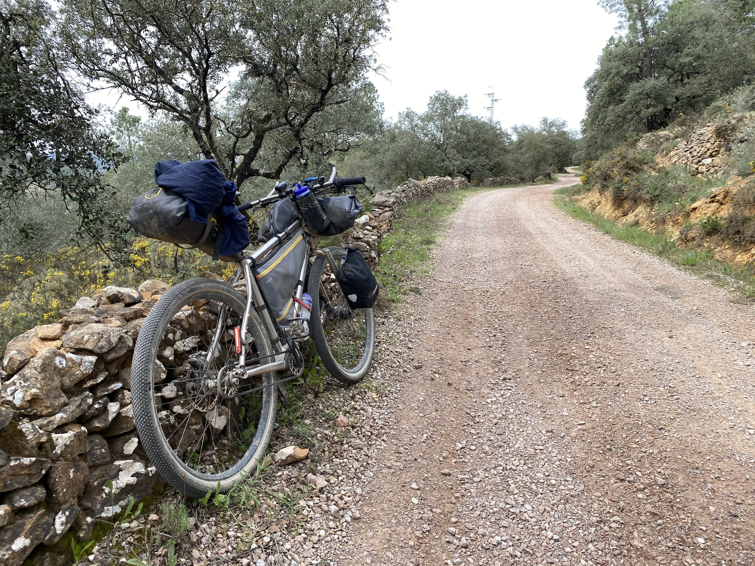
Ideal for a mountain bike or all-terrrain bike. Would also work fine for a gravel bike with low enough gears. I’d recommend a minimum of 40mm tires. I did this on my adventure bicyle, with 56mm tires.
When to go
Spring or autumn, with spring likely to be much greener. Parts of this are too isolated to safely cycle in summer. My trip was in March 2024.
Understanding the Sierra Morena
The Sierra Morena (dark mountain range) is a range of hills along the northern part of Andalucia. They aren’t particularly high but they are criss-crossed by valleys, forming a difficult to traverse barrier between the plains of Extremadura to the north and the fertile Guadalquivir plain to the south.
Due to the morphology and the acidic rocks, the area developed relatively poor, shallow soils suitable mainly for forests and thus remained relatively isolated until Roman times. Prehistoric sites are rare, with the best example being the dolmens La Sierrezuela in the foothills at Posadas, more likely a reflection of life in the Guadalquivir valley than the Sierra.
Roman period
Larger changes to the area started with the Romans who vastly increased the scale of mining and deforestation. Mining had existed in the area for thousands of years, due to the Iberian Pyrite Belt with abundant deposits of gold, silver, copper, tin, lead, and iron; though most activity was at Riotinto just to the south.
The deforestation promoted livestock grazing and development of farming for olives and vineyards in the valleys.
Al-Andalus
The Sierra Morena was part of the muslim area of Al-Andalus for almost 500 years from the 700s. This period brought stability introducing irrigation and terracing, thus allowing for the farming of almonds, figs and citrus. Forests began to be preserved for acorns and hunting, early signs of the agroforestry system. At times the Sierra Morena was the dark barrier between the Christian North and the Muslim South, and as with many border lands, fortifications abounded with particular examples now at Aroche, Aracena and Constantina.
Reconquista
In 1212 the Battle of Las Navas de Tolosa took place in the far east of Sierra Morena resulting in a crushing defeat for the Almohad Caliphate and leading to the fall of Cordoba in 1236. As a result of the “Reconquista” (the return of Christian state building in the Iberian peninsula) land became available for kings to cede rewards to the nobility leading directly to the establishment of feudal landholding systems, eliminating a social class of small private landholders. These large estates, the Latifundia, largely survive to the present day despite some fragmentation of ownership due to inheritance laws and economic pressures.
Wool industry
Wool was a very important good in the early middle ages and in 1273, King Alfonso X established the Honrado Concejo de la Mesta, generally known as the Mesta, which was the extremely powerful body that controlled the movement of sheep between high summer pastures and lower grounds in summer (transhumance). The Latifundia were an important part of this system: to accommodate the sheep during winter, large areas of forest were cleared leading to the creation of open woodlands with scattered trees.
Dehesas
During the 1500s and 1600s ownership of Latifundia consolidated further under noble families and religious owners. A pattern of usage emerged to maintain ecological balance, becoming the core of the system we know as dehesas:
Tree cover. Scattered oak trees provided shade for livestock and prevented soil erosion whilst maintaining a diverse habitat for wildlife.
Livestock grazing. Animals like sheep, cattle and pigs grazed beneath the trees, feeding on grasses, acorns, and crop residues.
Crop rotation: Seasonal crops were interplanted with grazing areas, allowing for soil regeneration and reducing pest and disease cycles.
Sustainable harvesting: Products like cork and firewood were harvested sustainably, maintaining tree health.
Impact of the industrial revolution
The industrial revolution in Northern Europe brought about huge changes in the textile industry during the 1700s. As a consequence the wool industry in Spain declined, and the rearing of sheep became less profitable. However the pigs that grazed the dehesas were more adaptable, they would eat the acorns between October and January and were less intensive to manage due to their semi wild nature.
The industrial revolution also brought high demand for copper, iron and other metals which spurred renewed mining efforts, marked by foreign investment, such as the Cala Mines syndicate from Manchester.
The 20th century to today
The 20th century saw depopulation in rural areas, often due to Franco’s policies of urbanisation to build a strong industrial economy. However by the late 20th century and into the 21st demand for high quality ham continued to rise and this has led to a revitalisation of the dehesas.
The dry, cool air of Sierra Morena is ideal for the curing process. Towns like Jabugo are dominated by this industry, producing everything from ordinary Serrano ham to premium Jamón Ibérico de Bellota, made exclusively from Iberian black pigs fed on acorns in the Sierra de Aracena. Local companies such as Cinco Jotas are thriving and the industry is attracting companies such as El Pozo, not normally associated with luxury hams.
Things to see in the Sierra Morena
The hill towns of the Sierra Morena are linked via ancient tracks for the movement of animals and people. Today they’re parts of the long-distance footpath GR38 and the mountain bike route Transandalus. One of the best self-guided bike tours in Andalucia.
This route starts in Aroche, a typically stunning white village and brown castle with plenty of cafes, restaurants and bars.
Just after Aroche there are many seemingly small scale pig farms in contrast to the eastern end of this bike route where the dehesas feel much larger. Perhaps it is because the west is more remote. There’s lots of cobbled tracks, bits of gravel and even some sections with more modern concrete.
Lunch in Cortegana was fantastic at the bar El Rincón de las Niñas. Three simple plates: tomatoes, ham and bread. I took lunch at the same time as the Spanish, which meant rush hour as soon as I finished. From being very still, the main street suddenly burst full of traffic as people reappeared to get back to work.
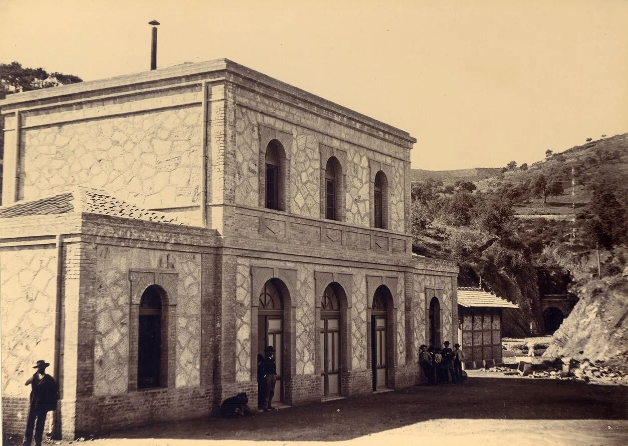
I bypassed Almonaster la Real, but the station in the valley is worth stopping at. This area is full of lush green valleys, tinkling streams, and vines in the trees. Plenty of animals to see such as goats, sheep, horses and of course pigs.
The track up to Jabugo is as pretty as it is steep, over 15% for a km or so.
Jabugo is the capital of ham and feels like people really work there. There’s a lot of curing buildings, some very large and very modern, generally along one side of the main steet. On the other side of the main street are a number of old school bars which are great places to stop and sample the local produce.
Next up is Galaroza, reached via a wonderful lush singletrack path. Galaroza is a long town with plenty of bars. I stayed at the old school, slightly modernist hotel at the south western end.
There’s literally a place called the “Enchanted Forest” just before Fuenteheridos, with its pollarded trees and green valleys.
On the way to Aracena there are more mossy stone walls by gravel tracks and you’ll pass through a few larger dehesas.
Aracena feels like the smart large town, where the lawyers and accountants for the ham tade might live. Again nice squares and a looming castle. I stopped for breakfast around 0900 at a cafe full of people wearing expensive jumpers and fancy sunglasses.
On leaving Aracena comes the hard work, the trails narrow and you’re sometimes on footpaths with steps to carry the bike up. You’ll pass through teh villages of Corteconcepción (with some lovely fresh asphalt out of town) and Puerto Moral (with its old church).
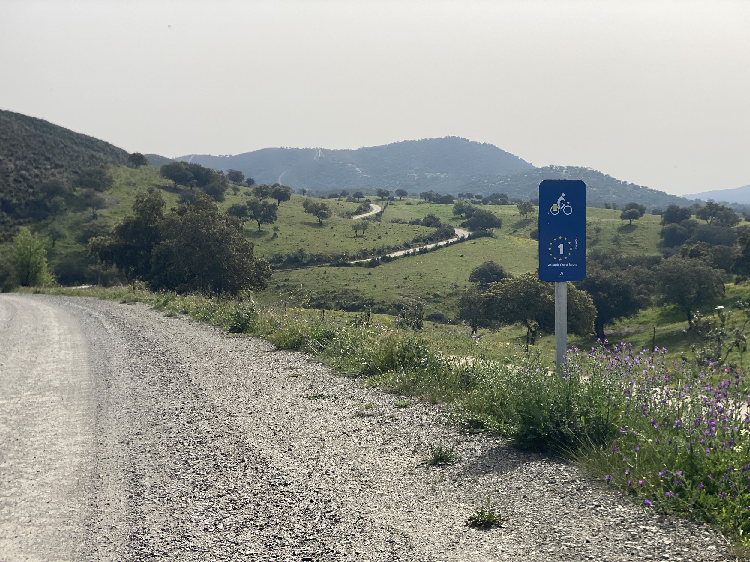
After Puerto Moral you’re back in the wild following Eurovelo 1 on some lovely wide flowing gravel tracks. I had planned to turn off the Eurovelo following the Transandalus but was blocked by a well-locked gate and no reasonable route over the fence. Problematically there’s also no phone reception so replanning wasn’t the easiest (note to self to use MapOut more and make sure the maps are downloaded).
However the re-routing meant a trip past the seemingly abandoned Minas de Cala, an old open pit mine, but with a quite wonderfully looked after cottage in a row of houses falling apart. I went to up to Cala, with yet another looming castle, before I got phone reception and found a route to folllow.
Another reason to be thankful for the detour was another open pit mine, which closed only 40 years ago: Mina de Teuler, with the nearby mine managers house. This is falling apart but has the air of an English stately home.
Santa Olalla del Cala was a great stop for food: Bar Restaurante Andalucía, where I got an exceptional 5 Euro burger.
Almadén de la Plata is next up, a pilgrim town with good value food and accommodation. You’ll likely see plenty of people walking the route of the Camino de Santiago that passes through here.
Leave town early morning and you’ll cycle downhill for 20km on a lonely gravel track that feels like you’re really heading into the wild. I think there’s one farm you’ll see in like 45km. There’s a big reservoir teeming with birdlife and then a steep uphill for 5km.
Cazalla de la Sierra with its orange trees lining the streets is a good place for a coffee stop, and remember to look back on it as you leave.
There’s a steep downhill to a picturesque valley under a railway viaduct, and you’ll also follow some old railway tracks: the Via Verde Sierra Norte.
Constantina was a busy town representing its trading history. Plenty of services and old commercial buildings. The only part that felt dilapidated was the castle above the town.
After Constantina is another 40km of lonely mossy gravel tracks, pretty much all of it downhill towards the large resevoir of Embalse Del Retortillo. You’re then very close to Hornachuelos, a town built on a rocky outcrop overlooking the Guadalquivir river plain.
Route
Getting there and back
The only reasonable way to get to Aroche (or even close by) is the train from Huelva to Almonaster-Cortegana. You can easily get to Huelva from Seville. The station at Almonaster-Cortegana is idyllic in the middle of the countryside. You can start the trip there (the route goes right past it) or cycle up to Aroche.
There’s no real station at Hornachuelos so I’d suggest continuing on to Posadas from where there’s very easy connections to Seville, Córdoba or even Málaga.
Almonaster-Cortegana Station, 1886
Baldomero Santamaría, Public domain, via Wikimedia Commons

